|
Teachers can use these activities however best fit their students and classroom. Many activities can be completed by individual students, small groups, the whole class, or as part of learning centers. In order to address all of the standards listed on the activity overview, all of these supplemental activities need to be completed. Some of the content statements and elaborations are only addressed through the supplements and are not included in the versions written in the Growing Up WILD (GUW) guide. Note: All supplemental materials are protected by copyright and are owned by Ohio Environmental Education Fund and Ohio Environmental Protection Agency. They may be used, with attribution, for educational purposes but are not to be used commercially. Please include Curious KIDSS and www.curiouskidss.org when citing the supplemental materials. All references to Growing Up WILD must include a reference to the Association of Fish and Wildlife Agencies, which holds the copyright to Growing Up WILD. Guides can be obtained through a workshop from the ODNR Division of Wildlife. When implemented as written, supplemental resources for the Growing Up WILD activity Oh Deer address the following content statements in the 2017-2018 Ohio Learning Standards for the following disciplines: Science
Social Studies
Math
English Language Arts
0 Comments
Follow the instructions for the Field Study Fun activity's Warm Up section provided in the Growing Up WILD guide. In #2 of the Procedure, one option is to follow the instructions given, while substituting the Curious KIDSS Data Collection sheet or the Curious KIDSS Science Notebook for the GUW Field Study Data Sheet. Another option is to rope off or set boundaries for a study plot to revisit during the year. Boundaries can be roped off or use natural boarders like a parking lot or fence or tree line. Within that set off space, students can use the hula-hoops to define the space for their small group’s observations. Curious KIDSS Data Collection Sheet In order to better align to Ohio’s Learning Standards, the data collection sheet for outdoor observations has been modified to specifically address Ohio's Learning Standards in social studies, mathematics and science for 2nd grade. The additions to the data collection sheet focus on collecting and monitoring weather data over long periods of time. While not explicitly addressed in the collection sheet, students should use the data they collected to look for weather patterns over seasons, cloud types and precipitation occurrence, wind speeds or directions and precipitation, While outside, ask students to find, record and share examples of the following concepts:
Follow the suggestions provided in the Growing Up WILD (GUW) guide. In order to address additional content from Ohio's Learning Standards in Mathematics, include and/or emphasize the following academic vocabulary:
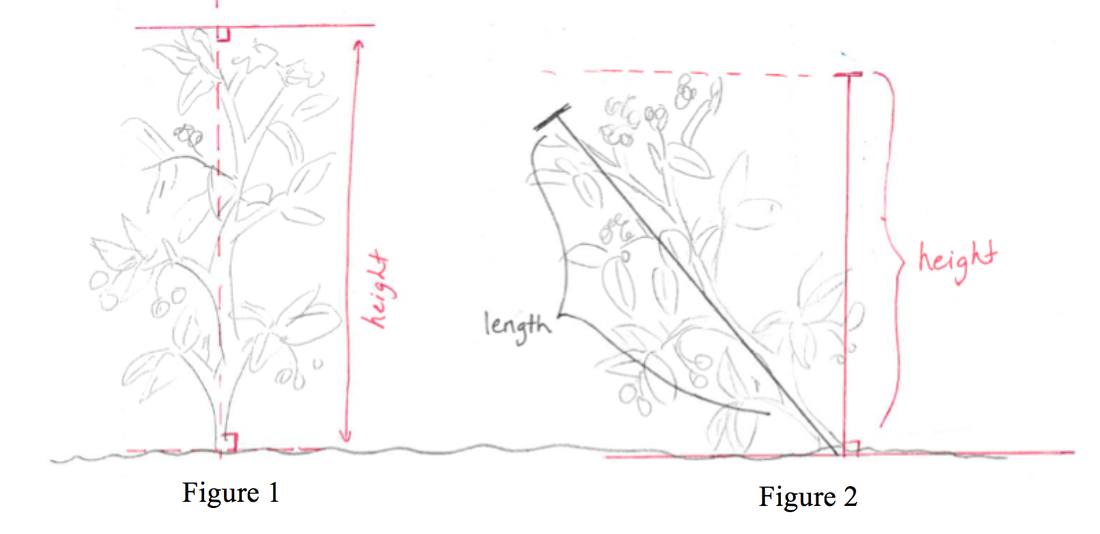 Students should select an appropriate measurement unit (feet, yards, or meters) and measure the length and width of their study area. Add a place for students to record their plant height, along with a place for the students to identify the units they used to measure the height. 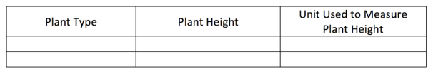 When students are in the field, direct them to record the time to the nearest 5-minute increment using both analog and digital clocks. Teachers should not provide this information as this will serve as practice for the students in telling and writing time. Students might begin by attempting to use only analog clocks and then confirm their time by referencing a digital clock.
Deletion of the inch ruler on the data sheet allows the students the opportunity to measure the height using appropriate tools. Allow students to decide if they think they need a meter stick, a ruler, etc. Then, have students measure the height of the plant (or other object) twice, using two different units of measure and allow them to describe how the two measurements relate to the size of the units that they chose to measure the plant with. Have students estimate the heights of the plants using inches, feet, centimeters, and meters prior to measurement. Have students compile the measurements of all students’ plant heights. Teachers can provide a giant line plot, marked off in whole number units, displayed in the classroom. Students can then plot the height of their individual plant. (2.MD.D.9) Discourse on the set of class data should ensue. Extending instruction to address 3rd grade content:
Students can maintain a class calendar to show weather data that students collect during their field visits. This display reinforces that time can be shown on calendars. Students can also compare weather data using bar graphs (rainy days vs. sunny days in September, rainy days in October vs. April, etc.).
Drawing maps of field study sites, including a map key, allows students to practice creating different types of maps, and practice using those maps to find the same study site over long periods of time. Each group could create a different section of the school grounds so that, when connected, would make a complete map of the property. Allow other groups within the class "ground truth" each others sections to identify additional features and for practice reading and using a map. Use the supplemental content that follows in addition to the suggestions in #6, #7 and the Wrap Up in the original activity. For the Music and Movement section of the original activity in the guide, use the GUW Field Study Data Collection pages to record weather data for the day. Students can sing the “What’s the Weather?” song before they share the data collected that day. Writing the words on sentence strips for students to read as they sing can be helpful for students to gain fluency. Weather data can be written on the class calendar to reinforce social studies standards. For the Centers & Extensions section of the original activity, students can create a Wall Journal – maps of the classroom, school, school grounds, field study site, etc., that students create can be displayed as murals and revisited throughout the seasons. Revisit Wildlife Poetry from Wildlife as Symbols. The focus of those poems was animals in that original activity but could easily include other living things or non-living things seen during their field studies. Students could use the Wildlife Poetry graphic organizers to help support their thinking about the poem and drawing to support their ideas.
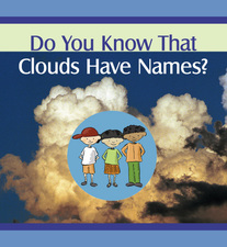 Curious KIDSS Data Collection sheets ask students to observe and record cloud types and amounts. Students can use their records to look for patterns between types and amounts of clouds and weather events (sunny days, rain today, rain in a few days, thunderstorms). The emphasis of this section is NOT for students to memorize cloud names. Students need to practice observing different cloud types and recording their observations. The emphasis is on finding patterns and making observations, not on the names of the types of clouds themselves. The Do You Know That Clouds Have Names? clouds storybook is created by the Elementary GLOBE program and contains teacher notes at the bottom of most pages. Read through these notes before reading the book to students. Often these notes contain additional content knowledge and explanations about what clouds look like and how they form.
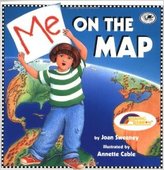 This series of activities can be used as an introduction to mapping for grades K-2. This series can be used as a stand-alone topic or as an introduction or extension to other activities. Students will use Me on the Map as an anchor text in order to create their own version of the book, using their school instead of their home.
As you read, you can ask students for examples from their own homes, or from their school. Using the school as the setting may prevent students from feeling uncomfortable about sharing details concerning their homes, especially if students may not have a home to reference. Based on class needs, the book can be read as a whole class read-aloud, in small groups (with or without teacher guidance), or individually. The following activities can be done by first reading the book, then creating a list of features, then drawing the map. An alternative would be to read the book and create the feature list, and then draw all of the maps.
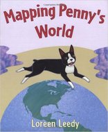 As part of the data collection, students will create maps of their study area. Before creating their own maps, read Mapping Penny’s World to students. Begin reading on the page “Penny likes to hide…” and read the following page “On this map….” Skip to page beginning “When we go out…” and read that page and the next one, “I made this….”
Explain to students that they will also be making a map. The map needs to include a title, a key and important features of their field study area. This area could be the entire school grounds, or a small area set aside for their study. Teacher Note: The page beginning “Mr. Jayson says…” contains a very detailed example of a map. For K and Grade 1, maps should focus on school or neighborhood features. At 2nd grade, student maps should contain a title and a key. The map in Mapping Penny’s World contains a scale and a compass rose. These map features will not be assessed at this grade level. All other activities in Field Study Fun align to Ohio’s Learning Standards in Science, Math, Social Studies and/or English Language Arts. As time allows, students can do these activities as a class, in small groups, or at centers.
|
||||||||||